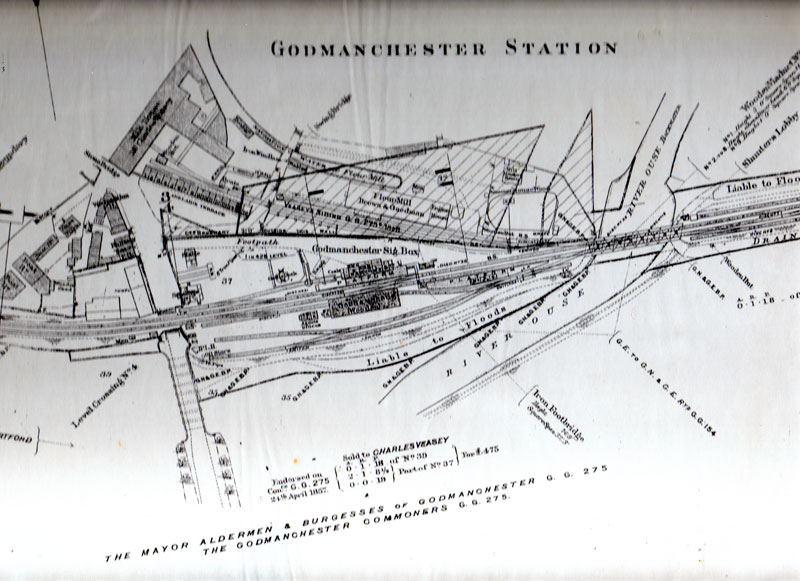
 Fig. 5The site of the mill on the Great Ouse and the waterway on the eastern side enabled buyers of linseed to unload and moor without difficulty. The semi-circular arched vault to the river side of the mill near the bridge (Fig 3) enabled the buyers to enter inside the building to unload linseed in a specially constructed dock. Equally important was the railway shown on Fig 5 for bringing in coal for the steam engine and for domestic use.
Fig.6 shows the railway line on a wooden trestle bridge crossing the river by the Riverside Mill with its chimney beside the 14th century bridge and the taller flour mill with its chimney in the middle distance. On the right, the arches of Cook's Bridge are just visible.
The date of the closure of the Oil Cake Mill is uncertain. Writing in 1911, F.W. Bird stated "it (the mill) has now been closed for sometime and no oil cake is made here now". There is some evidence that the mill was used during the Boer War (1899 – 1902) for making army uniforms. In the First World War (1914 – 1918) it was again used for making uniforms and also became a depot where uniforms were repaired and then ferried across the river on a steel cable to a laundry on the Huntingdon bank.
| Fig. 5 (Click to enlarge) |
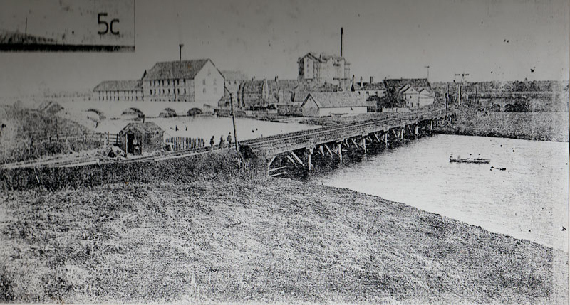 Fig. 6 (Click to enlarge) Fig. 6 (Click to enlarge) |
The two maps Figs.5 and 7 conflict as to when the Oil Cake Mill closed down. Fig 5 is a map drawn in 1904 for the railway management to show the lines and sidings in Godmanchester and to record the dates when the Veasey family purchased some of the adjoining land. It shows that Charles Veasey bought the siding in 1848 ie before the mill was built and presumably for use in the coal trade. It also shows the additional land bought by Veasey in 1857 on which Brown and Goodman built their flour mill in the early eighteen sixties although the Oil Cake Mill is called the Malt House. It is possible that it may be a mistake on the part of the map maker dating back to the time when the malting trade was one of the Veasey family's significant interests. The maps also show the Navigation Water on the east side of the mill which played a significant part in the success of the Oil Cake Mill.
In the enclosure map of 1803 this stretch of water is shown as a natural water drainage channel from a small pond close to the "River Ouse Backwater" known as Cake's drain. Later when the Oil Cake and Flour Mills were built this channel was centralised with brick walls and referred to as the Canal of the Dock. Now much shorter it is called The Cut.
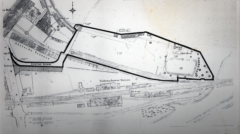 Fig. 7 (Click to enlarge)The date of Fig 7 is uncertain but is certainly later than the 1904 Fig 5 as it shows that the Flour Mill (Brown and Goodman) has been demolished and about half of the Navigation Water filled in. When the flour Mill chimney was felled the bricks were dumped in the pond to fill it up. The area outlined by the thick black line is now the site of the engineering firm, RGE, although the Riverside Mill is not fully named on this map, the letters "—ke" would appear to indicate the name in full would be "Oil Cake Mill". Whether it is still a working Oil Cake Mill when this map was drawn at some date after 1904 is uncertain, but this would agree with F.W. Bird's statement in 1911 that the mill "has now been closed for sometime".
It is certain that the mill stayed unused and empty between the closure of the Oil Cake Mill and the opening of the hosiery mill in the nineteen twenties.